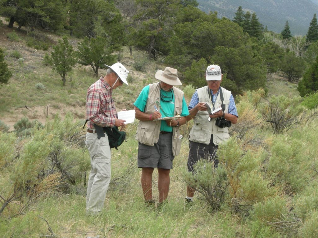
Fred Gaffney, Larry Holzworth, and Wendell Hassell, are double checking.
Botanizing the Colorado Valley’s and Mountains
Table of Contents
Introduction
Those convening were Larry Holzworth, Wendell Hassell, Wendall Oaks, Curtis Sharp, Scott Lambert and Fred Gaffney. New trekker Scott Lambert, retired Washington State Plant Materials Specialist, joined us, and was a valuable addition for his plant knowledge and pleasing ways. Regulars Jack Carlson had pressing family issues and Bob MacLauchlan was both unable to participate this go round.
We enjoyed the home and hospitality of Barbara and Wendall Oaks the night before our trek got under way on June 21. Wendell Hassell had developed a challenging and full agenda of 14 inventory sites and 1300 miles to travel through the beautiful high country of Colorado.
As with previous inventories, we used the nomenclature of the PLANTS database (http://plants.usda.gov). We recorded species as they were spotted, took photographs, and then used PLANTS county lists, and other databases for verification.
A plant inventory site may be an acre or a few acres or a smaller depending in the site characteristics. Ideally it will be an undisturbed and un-grazed area and be representative of a larger ecological type.
Power Botanizing, using the Carlson/Holzworth convention of 2009, means identifying all plant species found by group members at the stop, and the group cannot leave until it believes the inventory is complete. Unfortunately, this was rarely possible; rain, miles to travel before we sleep and darkness being our primary enemies.
During this Trek we identified plants of species at the 14 inventory sites. The most frequently
encountered plants were::
Day 1 – Wednesday June 21
On our drive up the east face of the Rockies, headed for the park Larry Holzworth shared his knowledge about the Big Thompson Irrigation Project. The Colorado-Big Thompson Project collects and delivers on average more than 200,000 acre-feet of water each year. Most of this water is the result of melting snow in the upper Colorado River basin west of the Continental Divide. The project transports the water to the East Slope via a 13.1-mile tunnel beneath Rocky Mountain National Park. Project water flows to more than 640,000 acres of irrigated farm and ranch land and 925,000 people in portions of eight counties. Parts of the aqueduct were visiable as we headed to the Rocky Mountain National Park
Inventory #1 – Rocky Mountain National Park Ski Slope
The Continental Divide run directly through the center of the park The headwaters of the Colorado River located in the park’s northwestern region. The main features of the park include mountains, alpine lakes and a wide variety of wildlife within various climates and environments, from wooded forests to mountain tundra.
The Park Act was signed by then–President Woodrow Wilson on January 26, 1915, establishing the park boundaries and protecting the area for future generations. The Civilian Conservation Corps built the main automobile route, named Trail Ridge Road, in the 1930s. In 1976, UNESCO designated the park as one of the first World Biosphere Reserves. In 2016, more than four and a half million recreational visitors entered the park, which is an increase of about nine percent from the prior year

Site characteristics of our first inventory: County: Larimer, Elevation: 9,500 feet; MLRA: Southern Rocky Mountains; pptn: 18” inches. It was certainly not a pristine site, having been a reseeded sky slope but had been invaded by many native plants over the years.
Scientific Name Common Name Type Origin
Following this inventor, which was uncharacteristic brief we reached the Alpine in the Sky Visitors Center by 2:00 PM and most of us enjoyed a quick lunch. However, Holzworth conducted an impromptu inventory close to the Visitors Center requiring him to climb a steep hill nearby. It was not a schedule inventory.
Inventory #2 – Rocky Mountain National Park Alpine in the Sky Visitors Center
Site characteristics: County: Larimer, Elevation: 11,796 feet; MLRA: Southern Rocky Mountains; precipitation 18 inches. The photo suggests the general lay of the land. Larry complained that he didn’t have time to cover it all.
Scientific Name Common Name Type Origin
From the Visitors Center we headed west out of the park, encountered a traffic jam caused by a deer being cited in the under brush Out went Oaks with camera returning with some excellent shots
Inventory #3 – Holzwarth Historic Site and Ranch
Then on to an historic site and ranch, owned by a relative of one of our team members, Larry Holzworth. The Holzwarth Historic Site is sometimes referred to as the Never Summer Ranch. Technically, however, there were two distinct businesses in this area.
John Holzwarth Sr., a German immigrant, moved to the Kawuneeche Valley in 1917 after his job as a saloon-keeper in Denver came to an abrupt end, a result of the enactment of prohibition in Colorado. Holzwarth took his family to the upper Colorado River at the foot of the Never Summer Mountains to build a homestead and start a cattle ranch. His location on the west side of the Colorado River (then known as the Grand River), and next to the newest national park, soon began attracting guests. The family decided to open a guest ranch, which they called the Holzwarth Trout Lodge.
As tourism in the Rocky Mountains increased over the next decade, the Holzwarth family began development of a dude ranch, which became known as the Never Summer Ranch.
The name of the ranch was taken from the nearby Never Summer Mountains. The Arapaho Indians called the range Ni-chebe-chii, which translates into “Never No Summer”. Wishing to avoid the use of a double negative, the U.S. Department of the Interior’s Board on Geographic Names settled on Never Summer Mountains. Prior to its official naming, the mountains were known as the Rabbit Ear Range.
Notwithstanding that the site had at some previous time been seeded to smooth brome, out third inventory was made.

This site is in Grant County, MLRA 48A, Southern Rocky Mountain. The elevation is 9,600 receiving about 20 inches rainfall yearly.
Scientific Name Common Name Type Origin
Day 2 – Thursday June 22
We spent a pleasant evening in Kemming. The next morning we traveled northwest on US Route 40 approximately 20 miles at which point we made a turn west and drove into the edge of Arapaho National Forest. Soon we found a ideal spot for our forth inventory even though there were some difficulty getting the vehicle to the location. We were not at Rabbit Ears Pass but could see it from our inventory site.
Inventory #4 – Rabbit Ears Pass
Rabbit Ears Pass, elevation 9426 feet, is a high mountain pass. The summit has the shape of rabbit ears, which displays two large columns of basalt rock formations from the second volcanic episode. Rabbit Ears Peak is underlain by a pink tuff and the basalt immediately to the west is underlain by red, vesicular ash. Volcanic breccia occurs only at the Peak, which is a large stratified breccia pile. The three basal layers are cut by a basalt dike immediately beneath the peak.[4] From petrographic evidence there appears to have been one period of lava flows and this surface can be seen at Rabbit Ears Pass


The Rabbit Ears Site is in Grant County, MLEA 24, Humbouldt, 24 inch rainfall and at 9,500 feet elevation.
Scientific Name Common Name Type Origin
Inventory #5 – Maybell
After leaving Rabbit Ears Pass site we return to route 40 and continued west stopping in Streamboat Springs for a pleasant lunch. Then west about 60 more miles to the small community of Maybell. The name may be famous for multiple reasons but it is for the plant materials program as the home and namesake of a cultivar of antelope bitterbrush.
Antelope bitterbrush is a slow growing shrub that is moderate to very deep rooted with wide ecotypic variations. It is normally 2 to 6 feet in height and up to 8 feet in width with wedge shaped, three lobed leaves (some are persistent in winter). Leaves can vary in color from grey green to bright green. Some plants have branches near the soil that layer (branches that touch the soil develop roots) providing additional rooting for the plant. Flowering occurs in late spring to early summer with yellow to white blossoms. The spindle-shaped seed shatters easily at maturity.
Antelope bitterbrush is adapted to a wide range of soils with 8 to 34 inches of annual precipitation. It is normally found at elevations of 4000 to 8500 feet, but has been noted at 11,000 feet in California. The shrub has good tolerance to drought and cold.

Antelope bitterbrush is an important native browse shrub in the intermountain Western United States. It occurs from New Mexico north to Colorado, Wyoming, Montana, and British Columbia, west to Idaho, and Washington, south to Oregon, California, and Nevada. It occurs most often as part of a mixed shrub community, but occasionally is found in nearly pure stands. It is associated with a variety of understory grasses and forbs. It can also be an understory plant in association with taller growing trees.
In spite of the fame this plant has brought to the local community, no one mentioned it at the ice cream shop. Not far from there we conducted our Maybell inventory.
This site is in Moffat County, MLRA 34A Central Desertic Basins, Mountains and Plateaus t about6,000 feet elevation, receiving 13 inches rainfall.
Scientific Name Common Name Type Origin
Upon completing the Maybell inventory we drove South about 30 miles to the community of Meeker, home of the Upper Colorado Environmental Plant Center. That evening we had the great pleasure of dinner with to formal employees of the plant center. One was Sam Stranathan. Sam was manager of the center from 1977 until 1992.Gary Noller, a long time agronomist at the plant center, also joined us. Both of these individuals contributive significantly to the productivity of the center for many years, and to our dining experience.
Day 3 – Friday June 23
Inventory #6 – Upper Colorado Environmental Plant Center

The Upper Colorado Environmental Plant Center is a non-profit facility owned and operated by the Douglas Creek and White River Conservation Districts. The Center works on revegetation of high elevation sites, to increase productivity of grazing lands in the cold desert, restore riparian zones, improve water quality, and enhance wildlife habitat. The Upper Colorado Environmental Plant Center works with NRCS and other Federal partners to select new conservation plants, increase native species for revegetation efforts, and develop new plant information.
National interest in significant deposits of oil-bearing shales, the economical recovery of that oil, and the successful revegetation of the disturbed sites related to oil extraction were the primary factors leading to the establishment of the Center. The Center is located adjacent to the world’s largest known deposit of these oil bearing shales.
The region supports one of the nation’s largest populations of elk and mule deer, and quality winter forage is critical for their survival. Range and wildlife plants must survive drought, range fires, insects, disease, and the encroachment of invasive, non-native plants. Marginal cropland needs plantings to convert them back to permanent vegetation. Abandoned croplands, which are losing water to municipal use, need to be vegetated with plants adapted to changed conditions. We enjoyed a spirited tour of th Center plantings, led by Steve Parr, reviving old but pleasant memories of days gone by.
Environmental Plant Center Staff:
Steve Parr, PMC Manager
Marti Walsh, Assistant Manager
Brandon Sanders, Farm Foreman
Johnnie Barton, Field Technician
The Center is located in Rio Blanco County, MLRA 34A Central Desertic Basins, Mountains, Plateaus about 6,000 feet elevation, receiving 13 inches rainfall. The entire enter is irrigated.
Planted identified on the Plant Center
| Scientific Name | Common Name | Notes |
| Indian ricegrass (Cody WY) | Acnatherum hymenoides | BLM project |
| milkvetch | Astragalus bisulcatus | BLM project |
| nodding bromegrass | Bromus anomalus | Bryce Canyon UT |
| Garret’ mountain brome | Bromus carinatus | Foundation field |
| Searles’ dalea | Dalea searleii | Seed increase field |
| Peru Creek tufted hairgrass (CO) | Deschampsia cespitosa | Breeder and Seed Increase fields |
| Pueblo’ bottlebrush squirreltail | Elymus elymoides | Foundation field |
| bottlebrush squirreltail (Massadona* CO) | Elymus elymoides | BLM project |
| bottlebrush squirreltail | Elymus elymoides | Crater Lake 2 accessions |
| bottlebrush squirreltail | Elymus elymoides | Bryce Canyon UT |
| Wapiti bottlebrush squirreltail | Elymus elymoides | Selected, seed incr, Rio Blanco Co. |
| blue wildrye | Elymus glaucus | Yosemite NP CA |
| San Luis’ slender wheatgrass | Elymus trachycaulus | Foundation field |
| Luna’ pubescent wheatgrass | Elytrigia intermedia | Foundation field |
| buckwheat (WY) | Eriogonum ovatifolium | BLM project |
| buckwheat (WY) | Eriogonum umbellatum | BLM project |
| Redondo’ Arizona fescue | Festuca arizonica | Foundation field |
| Thurber’s fescue | Festuca thurberiana | Buford CO |
| Gaillardia * | Gaillardia aristata | Seed increase field |
| Gaillardia | Gaillardia aristata | pollinator project |
| Timp’ northern sweetvetch | Hedysarum boreale | Foundation field |
| Sneezeweed (WY) | Helenium hoopsii | BLM project |
| annual sunflower | Helianthus annuus | pollinator project |
| Sunflower, native (WY) | Helianthus pumila | BLM project |
| Rocky Mtn iris (WY) | Iris missouriensis | BLM project |
| prairie junegrass | Koeleria macrantha | BLM project, Colorado Plateau |
| basin wildrye | Leymus cinerius | Picance Basin CO |
| Salina wildrye (CO) | Leymus salinus | Breeder and Seed Increase fields |
| Salina wildrye * (CO) | Leymus salinus | Price UT origin |
| Lewis’ flax (Colorado Plateau) | Linum lewisii | BLM project |
| tansy-aster (CO) | Machaeranthera canescens | BLM project |
| green needlegrass (Buffalo WY)* | Nassella viridula | BLM project |
| evening primrose (CO) | Oenethera caespitosa | BLM project |
| Soda Springs bitterbrush | P. tridentata | BLM project |
| Arriba western wheatgrass | Pascopyrum smithii | Foundation field |
| Penstemon (Colorado Plateau source) | Penstemon communaris | BLM project |
| Harrington’s penstemon | Penstemon harringtonii | BLM project |
| thickleaf penstemon (CO) | Penstemon pachyphyllus | BLM project |
| Bandera’ Rocky Mtn penstemon | Penstemon stricta | Foundation field |
| Rocky Mtn penstemon | Penstemon stricta | pollinator project |
| Sandberg’s bluegrass (Colo Plateau) | Poa secunda | BLM project |
| bluebunch wheatgrass | Pseudoroegneria spicata | SW WY, Iron Mtn |
| Yellowstone bluebunch wheatgrass | Pseudoroegneria spicata | Gardner Basin, Yellowstone NP |
| scurfpea (WY) | Psoralea tenufolia | BLM project |
| Maybell’ bitterbrush | Purshia tridentata | Foundation field |
| coneflower | Ratibida columnifera | BLM project |
| rudbeckia | Rudbeckia hirta | pollinator project |
| groundsel (CO) | Senecio integerrimus | BLM project |
| small-leaved globemallow (CO) | Sphaeralcea parvifolia | BLM project |
| four-nerve daisy | Tetraneuris acaulis | BLM project |
| Plains pea (WY) | Thermopsis rhombifolia | BLM project |
| *some potential seed increase |
Inventory #7 – Oil Shale Basin, Colorado
The Piceance Basin is a geologic structural basin in northwestern Colorado. It includes geologic formations from Cambrian to Holocene in age, but the thickest section is made up of rocks from the Cretaceous Period. The basin contains reserves of coal, natural gas, and oil shale.

Increasing demand for energy resources has spurred interest in energy alternatives such as oil shale. The Piceance Basin contains one of the thickest and richest oil shale deposits in the world and is the focus of most on-going oil shale research and development extraction projects in the U.S. The Piceance Basin has an estimated 1.525 trillion barrels of in-place oil shale resources and an estimated 43.3 billion tons of in-place nahcolite resources. This mineral is embedded with oil shale in many areas.[
This and the impact of mining it was a major impetus for establishing the Environment Plant Center.
Previously the plant center had established a large evaluation planting on a site that would mimic mining for the oil shale, Which We visited. This planning contained many species with revegetating potential. The plots were drilled with four replications of each species. The plants identified at the site are shown below. The picture is of one of the better established plots on this difficult site.
This site is located in Rio Blanco County, MLRA 34A Central Desertic Basins, Mountains, Plateaus about 6,600 feet elevation, receiving 11 inches rainfall
Scientific Name Common Name Type Origin
Day 4 – Saturday June 24
Inventory #8 – White River National Forest
Follow our second night’s lodging in Meeker we headed Southeast through the Danforth Hills until we reached the White River National National Forest, Which was our destination for Inventory #6.
White River National Forest is the most visited national forest in the nation encompassing 2.3 million acres. With 11 ski resorts, eight Wilderness areas, 10 mountain peaks over 14,000 feet and 2,500 miles of trails. It also turned out to be a very good Inventory sit, but we may have missed the peak bloom.

This site is located in Garfield County, MLRA 48A Southern Rocky Mountain about 9,200 feet elevation, receiving 20 inches rainfall
Scientific Name Common Name Type Origin
Upon completing the White River National Park inventory, we lunched in Glenwood Springs, then headed south on route 24 towards Leadville for Wendall’s next planned inventory site. Alas the best laid plans. We were at the correct location but not our contact person. It was to be at Camp Hale, the center of activity for the US Department of Defense mountain troops ski training center, which started in January, 1943, when the 87th Army Regiment officially moved there from Fort Lewis, Washington. Camp Hale was booming through the winters of 1943 and 1944. Extensive training in “army ski technique while carrying heavy packs was a mainstay, but snowshoeing, camping in the snow and many other activities, all conducted at or above 9000 feet and often in sub‐zero temperatures, hardened these troops into fit units indeed. On weekends, many of the men were allowed to travel, resulting in mad dashes to race at Alta and other ski areas in the West but also local dashes to explore the terrain around Aspen and Vail.
After a brief visit to the camp grounds, we moved on to Leadville for the night. Leadville reminded one trekker of a WV mining town, but on top of the mountain rather than being in the holler
Day 5 – Sunday June 25
Inventory #9– Monarch Park
This site was accessed as we traveled west on Route US 50 a few miles east of the community of Sargents, on the western slope but not far from Monarch Pass. The pass is located on the Continental Divide at the southern end of the Sawatch Range along the border between Gunnison and Chaffee counties, approximately 25 miles west of the town of Salida. The pass carries U.S. Highway 50 over the Sawatch Range, providing a route between Tomichi Creek in the upper basin of the Gunnison River on the west and the South Arkansas River, a tributary of the Arkansas River, on the east. Seven percent grades exist, and the area is prone to heavy winter snowfall, often resulting in temporary closures during severe winter storms. The site was in Fremont County, MLRA Southern Rocky Mountain at 10,500 feet elevation, receiving about 20 inches rainfall.
This site is in Saguache County, MLRA 48A Southern Rocky Mountain about 10,500 feet elevation, receiving 20 inches rainfall
Scientific Name Common Name Type Origin
Inventory #10– Crested Butte
Crested Butte is known as the wildflower capital of Colorado, with its endless meadows and hillsides of Crayola-colored blooms that grow to human height. Geologists have a hypothesis about the magnitude of the Butte’s wildflower bounty, and it’s mostly related to the shale soil that prevails in the mountain region.Trees turn up. their noses at growing in shale, which leaves lots of room for flowers and grasses to proliferate. An immense number of pollinators and much moisture also are a boon to the growing cycle of the natural bouquets. It was not on the original schedule but its strong attraction to several trek members led to a course adjustment
Hundreds of kinds of flowers thrive in the region, Lupine and mule’s ears, a member of the sunflower family, are in peak bloom now. They’ll give way to larkspur, Aspen sunflowers and Indian paintbrush. Snow still lingers in the area’s upper regions, and generally the season was a little late this year causing us to miss the peak.
Created Butte Site is in Gunnison County, MLRA Southern Rocky Mountain at 9,600 feet elevation, receiving about 24 inches rainfall.
Scientific Name Common Name Type Origin
Day 6 – Monday June 26
Inventory #11– Buffalo Pass –USFS Road 720, off CO Route 114
The 515,750 acres of the Rio Grande National Forest stretching from the rugged Sangre de Cristo Mountains on the east to the San Juan Mountains and the Continental Divide on the west. Are part of the Saguache (pronounced Suh-watch) District. Saguache is a Ute word that means, roughly, “water at the blue earth.” There may not be much blue earth or any big bodies of water in the Saguache Ranger district. However, what the district does offer is country that looks like people think the West should look like: vast stretches of wide open spaces with the Rocky Mountains as backdrop. The “lower” edges of the district start at about 8000 feet in elevation while the highest peaks in the Sangre de Cristo Wilderness scratch the clouds at over 14,000 feet.
The inventory site elevation was 8,500 feet; and in the High Intermountain Valleys MLRA and Saguache County but receiving only 10 inches of rainfall.
Scientific Name Common Name Type Origin
Inventory #12– Dunes National Park
How can something that is constantly shifting stand up to 750 feet tall? This southwestern park features the largest sand dunes in North America, and the key to their extraordinary height seems to lie in the combination of strong opposing winds and the presence of rivers and creeks, which capture drifting sands and redeposit them back on the dunes. Some of these remarkable hills are formations known as star dunes, molded by complex wind patterns into multi-pronged shapes, which look a bit like starfish from above.

Some of the first people to enter the San Luis Valley and the Great Sand Dunes area were nomadic hunters and gatherers whose connection to the area centered around the herds of mammoths and prehistoric bison that grazed nearby. They were Stone Age people who hunted with large stone spear or dart points now identified as Clovis and Folsom points. Like nearly everyone else until about 400 years ago, they walked into the San Luis Valley. They apparently spent time here when hunting and plant gathering was good, and avoided the region during times of drought and scarcity.
The Sand Dunes NP are in Alamosa County and MLRA 51, High Intermountain Valleys; at 8,400 feet elevation. It receives about 12 inches or rain/year.
Scientific Name Common Name Type Origin
Day 7 – Tuesday June 27
Inventory #13–San Isabel National Forest
The Pike and San Isabel National Forests & Cimarron and Comanche National Grasslands (PSICC) make up the most diverse forest throughout the five-state Rocky Mountain Region, covering three million acres and stretch between the prairies of western Kansas and some of Colorado’s highest mountain peaks along the Continental Divide.
The San Isabel National Forest is a ‘busy’ national forest noted for the majority of fourteen thousand foot peaks in Colorado. with numerous alpine lakes, reservoirs and key rivers. Over 1 million acres of Wilderness and contains the Continental Divide National Scenic Trail, Colorado Trail, and Santa Fe National Historic Trail.
150 millions years ago, this area was part of a large, shallow lake and was teaming with Brontosaurs and Allosaurs. As these massive beasts plodded along the muddy edge of this lake they left their footprints in the mud, which were eventually buried and turned to stone. Today, over 1,300 of these footprints, extending on a 1/4 mile plain, are exposed at the Picketwire Canyonlands dinosaur track site. Forty percent of the tracks were left by the Brontosaurs, a massive, four-footed plant eater.

The Inventory Site is in Custer County;, MLRA 28A, Southern Rocky Mountains at about 9,200 feet elevation; receiving about18 inches precip.
Scientific Name Common Name Type Origin
Inventory #14– Colorado Rt. 115 Turnoff, 10 miles North. of Penrose
Our last site was along Route 115 in Fremont County a few miles north of Penrose, CO, located in MLRA 49, Southern Rocky Mountain Foothills at 6,400 feet elevation receiving about 12 inches precip. It was not our most beautiful site and not all that represented of the surroundings landscape. (need site picture)
Scientific Name Common Name Type Origin
Summary
Following our last inventory, we made a bee line for the airport to drop off Scott who had an early evening flight and Fred who had an early (next day) flight, then to Longmont. No farewell Mexican dinner to toast our good fortune, but we all knew how glorious the time had been driving and wandering across the Rocky Mountains.
The circle was completed. We had traveled 1340 miles, Inventoried 14 sites containing ???? plants, seen much of the Colorado high country splendor and thoroughly enjoyed LOG Trek 10, to which we owe Wendall Hassell a major THANK YOU for developing it. Holzworth and Sharp enjoyed another night of the excellent hospitality at the Oaks home before heading home.
Regarding Trek 11 in 2018, there was a general agreement to meet in Lincoln, NB and make a forte east seeking ruminant tall grass prairie sites in Iowa, Missouri, etc., and picking up long time trekker Bob Maclauchlan at the beginning. A time frame was not identified but generally would be late growing season to help us find those four horsemen of the prairies and associated cousins.

Leave a comment